Beautiful shot!
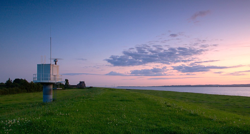
The structure is a stream gaging station, measuring the height of the water's surface. The vertical tube is a stilling well, connected to the river proper by a pipe that allows flow to the well so they're at the same level. Inside the well is a float sensor to measure the water surface, connected to a data recorder inside the upper structure. The antenna transmits the readings periodically to a computer system that processes the data and feeds it to the users (flood forecasters, databases, etc).
What can I say, this is what I do for a living (the database software for the US version of this setup)

Jim
EDIT: I just love Google maps - found your station at coordinates 51.667642, -2.555217


 Similar Threads


