 Originally posted by Jewelltrail
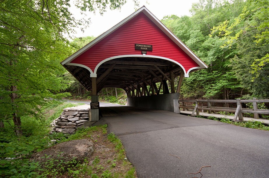
Thanks Tamia. It was built in 1886, so right in line with your dating. And yes, I agree, its affinity with railroad stations of the day is striking. Vermont particularly, but to some degree New Hampshire, are good states to find covered bridges.
The bridge is beautifully preserved. East-central NY has quite a few covered bridges, too, but not as elegant as this one of yours.
Originally posted by Jewelltrail Cool shot--I like how you have good detail in both sky and foreground, without clipping/underexposure in either--only in the trees, which are unimportant to the composition. Being a hiker, I understand how elusive steepness can be to 2-d pictures. Erosion is usually a sorry thing to see, except on the hiking trails where it is, for the most part, unavoidable.
Thanks JT. It was a beautiful day but also frustrating, because I loved the sky details and the sand details, and had a hard time bring out the texture of both. The woods were sacrificed, but I'd like to have brought out the details more.
Steepness... Have you found that shooting slopes from below or partially up them is more likely to emphasize their steepness? I've been experimenting and that's been my impression, and a telephoto zoom can really make them look steep.
Originally posted by Jewelltrail BTW, there doesn't seem to be much which you can not date. Can you provide we lay people with the geological clues which tip off the age and identity of the area demarcated by the unnatural erosion?
Hmmm, the best way to find out about the age of a formation is to do some homework into the geology of the area. In this case, I knew the geo history of the region from having studied here. This is a delta and beach complex that is part of a much larger set of formations which can be traced across northern NY and on to the western part of the state, though not in a continuous line.
Walking the top and the face of this part where I was shooting, you can observe the rocks and textures of the smaller sediments, and they give you a clue that it was washed by water at some point. It simply looks like a sandy beach, and a huge one at that. But it's hundreds of feet above the St. Lawrence Valley & Lake Ontario and there's not enough water to have created this feature.
Over time, geologists realized that there was a huge freshwater lake at this level, and it was formed by glacial meltwater which was trapped between the Adirondack Mountains and the continental glacier which was receding to the north. When the glacier retreated further north, the sea invaded, with a level about 300 feet below this high point. More deltas and beaches formed along the shore, and in those marine fossils are sometimes eroded out (seals, whales, shells).
The history's more complex than I've let on. It's a fascinating study.


 Post #3663 by Arizona Dave
 Similar Threads


