 |
| 824 Likes | Search this Thread |


| 03-09-2017, 08:04 AM | #287 |
| | |


| 03-10-2017, 11:19 AM | #290 |
| 03-24-2017, 06:20 PM | #292 |
| 03-28-2017, 08:18 PM | #294 |
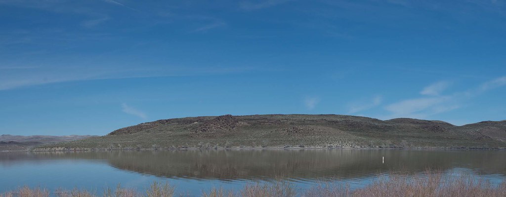
| Dead camel mountain | |
| 03-29-2017, 06:42 PM | #295 |
| Last edited by WPRESTO; 05-01-2017 at 04:38 AM. | |
| 03-31-2017, 12:17 PM | #296 |
| | |
| 04-30-2017, 06:29 PM | #298 |
| 04-30-2017, 06:53 PM | #299 |

|
| Bookmarks |


| Tags - Make this thread easier to find by adding keywords to it! |
| bell, bones, bowers, canyon, canyonlands, castle, chalk, challenge, contest, edinburgh castle, entries, examples, fire, flickr, germany, image, miles, nature, noel, park, post, rense, reservoir, rock, smith, springs, thread, time, topic, utah |
 Post #942 by Geodude
  Similar Threads
 | ||||
| Thread | Thread Starter | Forum | Replies | Last Post |
| Weekly Challenge #251 - WINNERS The Earth's Bones | Tamia | Weekly Photo Challenges | 8 | 07-30-2013 11:05 AM |
| Weekly Challenge #251 - The Earth's Bones | Tamia | Weekly Photo Challenges | 25 | 07-27-2013 04:00 AM |
| Photos of the earth from space -- wow :) | Alliecat | General Talk | 8 | 06-04-2012 08:20 PM |
| Misc Old bones | Photopat | Post Your Photos! | 8 | 12-27-2011 12:42 PM |
| Landscape Earth, Water, & The Sky.. | minahasa | Post Your Photos! | 6 | 08-28-2011 02:08 PM |


